Trail Nordic walking Le Crotoy - Parc Marquenterre - Photo

Parc Marquenterre

 domifon
domifon

User

© OpenStreetMap contributors
Length
Length
22 km
Max alt
Max alt
27 m
Uphill gradient
Uphill gradient
117 m
Km-Effort
Km-Effort  
24 km
Min alt
Min alt
0 m
Downhill gradient
Downhill gradient
117 m
Boucle
Boucle
Yes
Creation date :
2014-12-10 00:00:00.0
Updated on :
2014-12-10 00:00:00.0

(0 Reviews)

Nordic walking
Nordic walking
--
Difficulty : Medium

Scan this QR Code to open this trail in the SityTrail application

FREE GPS app for hiking

Logo SityTrail SityTrail

IGN / Geographical institutes

Download SityTrail from the App Store Download SityTrail from Google Play

Logo SityTrail SityTrail World

The world is yours!

Download SityTrail from the App Store Download SityTrail from Google Play Download SityTrail on Huawei AppGallery

About

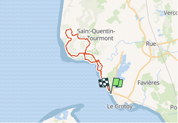
Trail Nordic walking of 22 km to be discovered at Hauts-de-France, Somme, Le Crotoy. This trail is proposed by domifon.

Description

Du Crotoy Pkg Nord ballade dans le Parc du Marquenterre

Elevation profile

Positioning

Country:
France
Region :
Hauts-de-France
Department/Province :
Somme
Municipality :
Le Crotoy
Location:
Unknown
Start:(UTM)
400969 ; 5564930 (31U) N.

Trails nearby

Trail Walking Saint-Valery-sur-Somme - Balade à Saint-Valéry-sur-Somme - Photo
Walking
GUIDE
Desrumaux

Walking

Easy
(4)
Saint-Valery-sur-Somme, Hauts-de-France, Somme, France
10.4 km | 12.2 km-effort
2h 41min
Yes
Trail Walking Le Crotoy - CDT80-3 - Photo
Walking

Walking

Medium
(2)
Le Crotoy, Hauts-de-France, Somme, France
6 km | 6.1 km-effort
1h 23min
Yes
Trail Walking Cayeux-sur-Mer - Le Hourdel V2 - Photo
Walking
tracegps

Walking

Difficult
(1)
Cayeux-sur-Mer, Hauts-de-France, Somme, France
8 km | 8.4 km-effort
2h 30min
Yes
Trail Walking Saint-Valery-sur-Somme - Balade à Saint-Valery sur Somme - Photo
Walking
tracegps

Walking

Medium
(3)
Saint-Valery-sur-Somme, Hauts-de-France, Somme, France
7.1 km | 8.6 km-effort
2h 19min
Yes
Trail Walking Favières - Circuit de Morlay - Photo
Walking
tracegps

Walking

Difficult
(1)
Favières, Hauts-de-France, Somme, France
12.4 km | 12.8 km-effort
4h 0min
Yes
Trail Cycle Rue - Rue-Ailly sur Somme par les chemins de Halage - Photo
Cycle
Baltykatt

Cycle

Medium
(2)
Rue, Hauts-de-France, Somme, France
75 km | 76 km-effort
4h 39min
No
Trail Walking Saint-Valery-sur-Somme - w-frankrijk-over-dijken-en-kwelders - Photo
Walking
gpstracks

Walking

Very easy
(2)
Saint-Valery-sur-Somme, Hauts-de-France, Somme, France
13.8 km | 14.9 km-effort
Unknown
Yes
Trail Equestrian Le Crotoy - de la Maye vers marquenterre - Photo
Equestrian
ioudina

Equestrian

Very easy
(4)
Le Crotoy, Hauts-de-France, Somme, France
20 km | 21 km-effort
2h 43min
No
Trail Cycle Le Crotoy - Crotoy - Marquenterre - Photo
Cycle
jacques.moulin@hotmail.com

Cycle

Medium
(1)
Le Crotoy, Hauts-de-France, Somme, France
18.3 km | 19.2 km-effort
1h 8min
Yes


Close
My subscriptions